Follow the sequence
A cyclone reaches the coast
Terra MODIS observed the storm as it reached northeastern Libya. Libya’s National Meteorological Centre, quoted by WMO, identifies 10 September as the local peak of the storm.
The daily rainfall window closes
Al-Bayda’s reported 414.1 mm accumulation covers 08:00 on 10 September to 08:00 on 11 September. WMO reports flash flooding and the failure of two dams affecting Derna.
A regional aftermath view
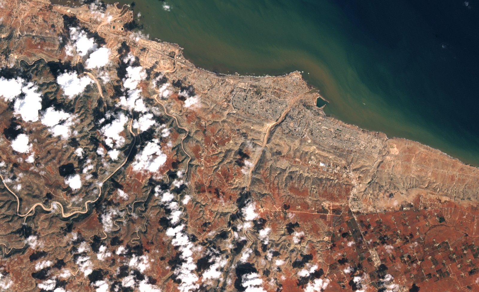
Terra MODIS observed the affected region again. NASA describes sediment entering the Mediterranean, while noting that damage within Derna is difficult to resolve at the sensor’s scale.
Basis: World Meteorological Organization, reporting Libya National Meteorological Centre [1] · NASA Earth Observatory [2]
Selected observations & analyses
These entries preserve the source’s reported quantities or analyses. They are not a newly processed observational dataset.
| Evidence | Reported value or finding | Provenance |
|---|---|---|
| Al-Bayda daily rainfall | 414.1 mm in 24 hours | Libya National Meteorological Centre observation relayed by WMO; 08:00 10 September to 08:00 11 September 2023, with the source’s local reporting times retained. |
| Regional satellite evidence | Terra MODIS, 10 and 13 September | NASA Earth Observatory identifies a storm view on 10 September and a later surface/sediment view on 13 September; neither is a city-scale flood-depth survey. |
The atmospheric mechanism
A slowly evolving low-pressure system can transport moist maritime air toward the coast and maintain ascent over the same region. Northeastern Libya’s coastal relief adds another opportunity for rising air and concentrated runoff. The important progression is from atmospheric delivery to water moving through a catchment. Rain measured at one point enters a landscape with slopes, channels and storage; the flow reaching a downstream city depends on that entire connected system.
The failure of a dam changes the downstream flood problem abruptly. Stored water can be released in a pulse that a rain gauge cannot describe. This is why the rainfall record should not be presented as a complete explanation of Derna’s destruction. The atmospheric trigger, the routing of runoff and the behavior of infrastructure each require their own evidence. Satellite imagery can show cloud structure, changed surface water or sediment transport, but its perspective does not by itself reconstruct the timing or hydraulic force of a dam-break wave.
Basis: World Meteorological Organization, reporting Libya National Meteorological Centre [1] · NASA Earth Observatory [2]
What the evidence does not establish
Al-Bayda and Derna are different places; the 414.1 mm total must not be assigned to Derna. The daily accumulation is not an hourly rain rate. WMO’s account combines meteorological and disaster information, while NASA explicitly notes the limitations of MODIS resolution. This case does not calculate dam loading, breach timing, local flow velocity or individual causes of loss.
Trace the chain from rain to runoff to downstream exposure, keeping the observation location and infrastructure evidence separate at every step.
Sources & provenance
- Libya floods show need for multi-hazard early warnings, unified response World Meteorological Organization, reporting Libya National Meteorological Centre · 2023-09-14Reference only; original paraphrase; no source media reproduced.
- Torrential Rain Wreaks Havoc in Libya NASA Earth Observatory · 2023-09-14Reference only; original paraphrase; no source media reproduced.
Explanations and diagrams are original educational interpretations. Source institutions have not endorsed or reviewed this publication. How we distinguish evidence from models.