Follow the sequence
A cyclone in the channel
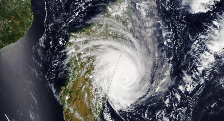
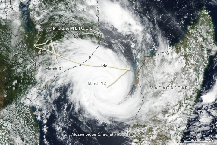
The Malawi meteorological service documented a cyclone in the Mozambique Channel and issued advance guidance about the approaching system.
Landfall near Beira
WMO reports coastal landfall at 23:30 GMT on 14 March. Coastal winds, heavy rain and sea-level effects accompanied the event.
Flood extent is mapped
Copernicus reported maps made from satellite imagery acquired on 16–19 March. The mapped footprint belongs to the acquisition time and does not directly give water depth.
Basis: World Meteorological Organization [1] · Copernicus Emergency Management Service [2] · Malawi Department of Climate Change and Meteorological Services [3]
Selected observations & analyses
These entries preserve the source’s reported quantities or analyses. They are not a newly processed observational dataset.
| Evidence | Reported value or finding | Provenance |
|---|---|---|
| Landfall timing | 14 March 2019, 23:30 GMT | WMO report dated 15 March; near Beira, Mozambique. |
| Early surge estimate | Approximately 2.5 m | WMO initial report; an estimate, not a universal coastal water level or final inundation survey. |
| Mapped flooded area at Mafambisse | 146.2 km² in one monitoring map | Copernicus EMS emergency mapping; footprint at satellite acquisition, not the total event footprint. |
The atmospheric mechanism
A tropical cyclone can push water toward the coast while also producing rain over land. Those pathways share a weather system but are not the same process. Surge depends on the wind field, coastline, water depth and tide. Rainfall-related flooding depends on where water falls, how wet catchments already are, and how it moves downstream. A wind category cannot express both.
For a Southern Hemisphere cyclone, the broad rotation convention is clockwise. That is useful when reading the large circulation, but does not justify guessing exact local winds from a schematic circle. The event’s real track and local geography matter. Compare the wind lab’s hemisphere switch with the documented landfall location, then keep the lab’s idealized flow separate from measured or analyzed Idai winds.
Basis: World Meteorological Organization [1] · Copernicus Emergency Management Service [2] · Malawi Department of Climate Change and Meteorological Services [3]
What the evidence does not establish
The WMO account was issued while impacts were still being assessed, so its surge value remains labelled an early estimate. The Copernicus map describes water extent, not the mechanism behind every flooded pixel; a combination of sources is needed to distinguish river, rainfall and coastal contributions. Neither product alone establishes household-level inundation depths or a complete final damage inventory.
Keep three questions apart: how strong were the winds, how high did coastal water rise, and where did rainwater accumulate? A cyclone name connects these questions but does not answer them.
Sources & provenance
- Tropical Cyclone Idai hits Mozambique World Meteorological Organization · 2019-03-15Reference only; original paraphrase; no source media reproduced.
- Copernicus EMS Monitors Major Tropical Cyclone in Mozambique Copernicus Emergency Management Service · 2019-03-20Reference only; original paraphrase; no source media reproduced.
- Statement on Tropical Cyclone Idai in the Mozambique Channel Malawi Department of Climate Change and Meteorological Services · 2019-03Reference only; original paraphrase; no source media reproduced.
Explanations and diagrams are original educational interpretations. Source institutions have not endorsed or reviewed this publication. How we distinguish evidence from models.