Follow the sequence
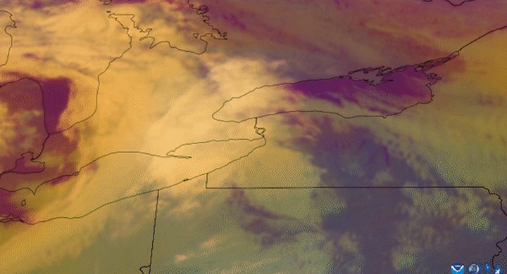
A coastal low appears
The National Weather Service assessment first identifies a weak surface cyclone off South Carolina during the afternoon. Its later New England effects developed through subsequent intensification and a change in the system’s movement.
Snow and wind overlap
Heavy snow and strong winds affected southern New England. The Boston NWS retrospective identifies a four-hour afternoon interval with sustained winds meeting the wind component of its blizzard criterion.
Slow motion prolongs exposure
The federal assessment describes the mature storm moving very slowly south of New England overnight before progressing east-northeast. Snow totals accumulated over the episode rather than arriving in a single short burst.
Basis: NOAA National Weather Service [1] · NOAA National Weather Service Boston [2]
Selected observations & analyses
These entries preserve the source’s reported quantities or analyses. They are not a newly processed observational dataset.
| Evidence | Reported value or finding | Provenance |
|---|---|---|
| Sustained-wind interval | 35 mph or stronger for at least three hours; Boston interval 14:00–18:00 EST on 6 February | NWS Boston, Blizzard of 1978 retrospective; this describes sustained wind, not the peak gust. |
| Reported peak gusts | 83 mph at Boston and 92 mph on Cape Cod | NWS Northeast Blizzard of 1978 assessment, meteorological-conditions chapter. |
| Regional snowfall | Roughly one to three feet from Delaware to Massachusetts | The federal assessment’s regional summary; this range is not a uniform depth across the corridor. |
The atmospheric mechanism
The surface cyclone and the circulation higher in the atmosphere became closely associated as the storm matured. A slowly moving low can keep a location within moist, rising air for longer than a fast-moving system with otherwise similar snowfall rates. Accumulation therefore depends on persistence as well as intensity. A weather map at one time cannot establish how long that favourable arrangement lasted.
Snowfall and a snowdrift are different quantities. Falling crystals add mass to the surface, while wind redistributes existing snow into sheltered areas and removes it from exposed ones. This makes a photograph of a very deep drift a poor substitute for a measured snowfall total. The nearby Atlantic also supplied moisture, but the storm’s temperature structure determined where precipitation could remain snow through its descent.
Basis: NOAA National Weather Service [1] · NOAA National Weather Service Boston [2]
What the evidence does not establish
The retrospective sources use different reporting conventions for some snowfall totals, so this account does not combine their station numbers into a new ranking. Gusts, sustained winds, snow depth and snowfall are kept separate. A blizzard describes combined wind and visibility conditions; neither a large snowfall total nor a single powerful gust proves that those conditions persisted everywhere.
Track how long a site remains in the snow-producing circulation, and distinguish newly fallen snow from snow rearranged by wind.
Sources & provenance
- Northeast Blizzard of 1978: meteorological conditions and guidance NOAA National Weather Service · 1978 assessmentReference only; original paraphrase; no source media reproduced.
- Blizzard of 1978 retrospective NOAA National Weather Service Boston · Publication date not stated; retrospective event accountReference only; original paraphrase; no source media reproduced.
Explanations and diagrams are original educational interpretations. Source institutions have not endorsed or reviewed this publication. How we distinguish evidence from models.