What was observed
An astronaut records the scene
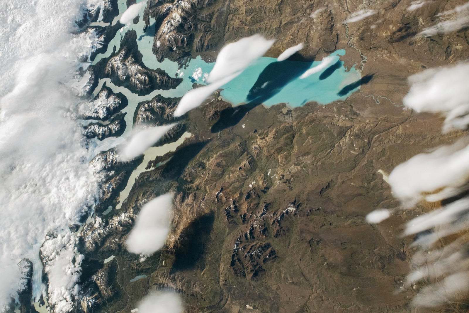
ISS photograph ISS074-E-8940 captured the cloud shapes above Lago Argentino. The source provides this acquisition date; the case does not treat the later scientific discussion as another weather observation.
Basis: NASA Earth Observatory [1] · World Meteorological Organization, International Cloud Atlas [2]
Selected observations & analyses
These entries preserve the source’s reported quantities or analyses. They are not a newly processed observational dataset.
| Evidence | Reported value or finding | Provenance |
|---|---|---|
| Photographic record | ISS074-E-8940 | NASA ISS Crew Earth Observations photograph acquired 27 December 2025; article published 15 January 2026. |
| Reported cloud-top retrieval | About 9,200 m and 220 K | MODIS estimates described by NASA Langley scientist Hazem Mahmoud in the article; retrieval acquisition time is not stated alongside them. Indirect cloud-top properties, not a thermometer inside the cloud. |
| Cloud identification | Likely lenticular; not definitive | NASA’s consulted scientists retained uncertainty between lenticular and cumulus interpretations and called for more vertical-structure evidence. |
The atmospheric mechanism
In stable air, flow crossing a mountain can oscillate downstream. Where the moving air rises it expands and cools; if sufficiently moist, cloud can form near a wave crest. Descending air warms and cloud can evaporate. The World Meteorological Organization explains that the wave pattern may remain nearly stationary while air continues through it. A cloud that seems to hover therefore does not necessarily indicate weak winds.
That mechanism is a candidate for this scene, not a complete reconstruction. The photograph supplies shape and location; the reported MODIS retrievals add information about cloud-top height and temperature. Different kinds of evidence can strengthen a hypothesis without eliminating every alternative. A useful next step would be a sequence showing whether the cloud pattern remains tied to the terrain, together with observations of its thickness and the surrounding wind profile.
Basis: NASA Earth Observatory [1] · World Meteorological Organization, International Cloud Atlas [2]
What the evidence does not establish
NASA explicitly says the available view is insufficient for a definitive classification. Suggested contributions from lake moisture, ice sublimation, shear or turbulence remain proposed explanations rather than measured budgets for this cloud. Cloud-top temperature cannot determine the temperature at the lake, and a high cloud top alone cannot distinguish a thin layer from a deep cloud below it. The published photograph was cropped and contrast-enhanced by its provider; this text-only case reproduces no photograph.
Keep three statements separate: what the image shows, what an instrument estimates, and what a scientist infers. Naming the missing observation makes uncertainty useful instead of hiding it behind a confident cloud label.
Sources & provenance
- Clouds Swimming over Lago Argentino NASA Earth Observatory · 2026-01-15Reference only; original paraphrase; no source media reproduced.
- Orographic influence on the leeward side, Section 2.4.3 World Meteorological Organization, International Cloud Atlas · Publication date not statedReference only; original paraphrase; no source media reproduced.
Explanations and diagrams are original educational interpretations. Source institutions have not endorsed or reviewed this publication. How we distinguish evidence from models.