Follow the sequence
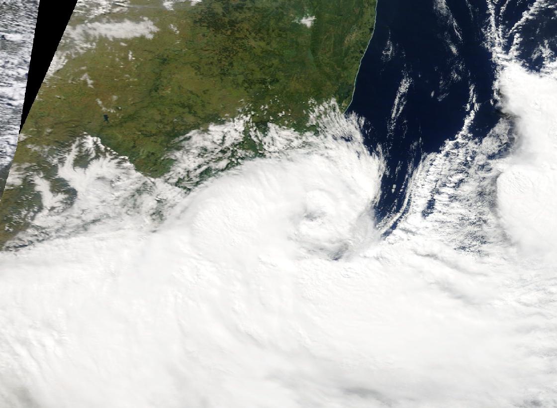
An upper low affects the region
South African official accounts identify a cut-off low over the southern and eastern part of the country, with high pressure to the southeast.
Rain intensifies overnight
Official accounts describe the intense rain across 11–12 April, including the overnight period when flood impacts escalated.
Large 24-hour totals are reported
Numerous stations recorded exceptionally high amounts. Flooding and landslides followed; their exact local causes required evidence beyond the rain totals alone.
Basis: World Meteorological Organization, citing South African Weather Service [1] · South Africa Department of Water and Sanitation [2] · Atmosphere, peer-reviewed event study [3]
Selected observations & analyses
These entries preserve the source’s reported quantities or analyses. They are not a newly processed observational dataset.
| Evidence | Reported value or finding | Provenance |
|---|---|---|
| Regional rainfall magnitude | 200–400 mm in 24 hours in affected areas | WMO’s 21 April report, relaying South African authorities; regional range, not a uniform amount. |
| Confirmed heavy station totals | Several stations exceeded 300 mm | South African Weather Service reporting and subsequent meteorological studies. |
| Synoptic diagnosis | Upper-air cut-off low | SAWS analysis; a circulation feature aloft, not simply an isolated surface pressure minimum. |
The atmospheric mechanism
A cut-off low is a circulation separated from the main upper-level westerly flow. It can move slowly and create a favorable setting for ascent and instability. In the April event, a moist onshore environment and smaller-scale systems helped focus rain near the east coast. Subsequent research examined interactions between a convective system and a coastal low, adding detail to the broad official diagnosis.
The distinction between scale levels is useful. An upper-air chart describes the larger environment, radar describes the changing precipitation organization, and a gauge measures water at a point. None alone provides the whole chain. In the storm lab, changing an ingredient changes an idealized outcome; the real event requires the spatial arrangement and timing of ingredients, not just whether each is marked present.
Basis: World Meteorological Organization, citing South African Weather Service [1] · South Africa Department of Water and Sanitation [2] · Atmosphere, peer-reviewed event study [3]
What the evidence does not establish
The reported 200–400 mm range applies to affected locations and a 24-hour interval. It is not a province-wide mean or a measurement of flood depth. A cut-off low does not always produce such an outcome, and naming the system is not a complete causal explanation. Event attribution and the contribution of land use or drainage must be evaluated with separate, explicitly defined studies.
Read upward as well as outward: a surface map, an upper-air pattern and local rainfall observations describe different levels of the same episode. Connecting them is more informative than naming one weather system.
Sources & provenance
- South Africa declares state of emergency after deadly rains World Meteorological Organization, citing South African Weather Service · 2022-04-21Reference only; original paraphrase; no source media reproduced.
- National State of Water Report 2022: extreme events South Africa Department of Water and Sanitation · 2022 reportReference only; original paraphrase; no source media reproduced.
- April 2022 Floods over East Coast South Africa: Interactions between a Mesoscale Convective System and a Coastal Meso-Low Atmosphere, peer-reviewed event study · 2023-01Reference only; original paraphrase; no source media reproduced.
Explanations and diagrams are original educational interpretations. Source institutions have not endorsed or reviewed this publication. How we distinguish evidence from models.