What was observed
Fog persists while its northern edge changes
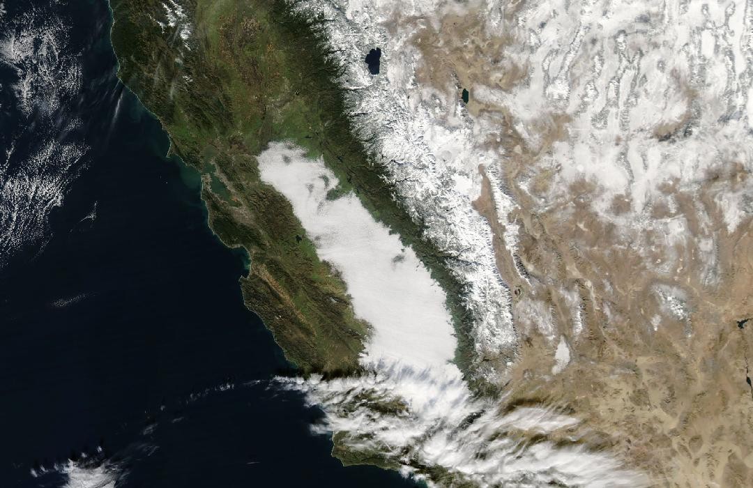
CIMSS documented fog across much of the Central Valley using GOES-11 visible imagery and MODIS products. The northern part began eroding during the afternoon while much of the remaining fog changed little, so one still image would miss a meaningful part of the story.
Basis: Scott Bachmeier / University of Wisconsin–Madison CIMSS [1] · NASA Earth Observatory [2]
Selected observations & analyses
These entries preserve the source’s reported quantities or analyses. They are not a newly processed observational dataset.
| Evidence | Reported value or finding | Provenance |
|---|---|---|
| Observed afternoon evolution | Erosion along the northern part of the fog, with persistence over much of the remainder | CIMSS analysis of the 5 January GOES-11 visible-image sequence; an observed spatial change rather than a uniform clearing time. |
| Product spatial detail | Approximately 1 km MODIS versus 4 km GOES-11 fog/stratus products in the comparison | CIMSS identifies sharper fog-edge detail in the finer-resolution MODIS product. |
| Retrieval limitation | The cloud-top-temperature product misidentified some cold snow-covered mountains as cloud | CIMSS case analysis; a documented classification error over the Sierra Nevada, separate from the valley fog. |
The atmospheric mechanism
Tule fog commonly develops when moist valley air cools toward saturation in a stable winter boundary layer. Surrounding terrain can help confine the cool air, while weak mixing limits exchange with drier air above. Once a thick layer forms, it can reduce sunlight reaching the surface and slow the heating that might otherwise help clear it. These are compatible formation and persistence processes, not a reconstructed temperature sounding for this particular day.
The instruments offer different strengths. A geostationary satellite can repeatedly watch the same region and reveal an edge retreating with time. A polar-orbiting pass can provide finer spatial detail but only at its overpass time. Combining the two helps separate a genuine changing boundary from the effect of pixel size. Neither improvement removes the need to understand what a retrieval measures.
Cold snow and cloud can produce confusing thermal signals. The reported misclassification is therefore a useful counterexample to treating a coloured satellite product as ground truth. A visible image, terrain knowledge and surface observations can help test the classification. Apparent brightness alone does not establish whether a white feature is snow on a mountain or droplets suspended over a valley.
Basis: Scott Bachmeier / University of Wisconsin–Madison CIMSS [1] · NASA Earth Observatory [2]
What the evidence does not establish
Satellite views show the top of a cloud or fog layer; they do not directly establish visibility at every road or whether cloud reaches the surface everywhere. The NASA background source illustrates a different Central Valley fog day, 17 January 2011, and is used only for formation context. No observations from that later scene are reassigned to 5 January.
Use image sequences for change, finer pixels for boundaries and independent observations for identification; no single satellite product answers all three questions.
Sources & provenance
- Tule fog in the Central Valley of California Scott Bachmeier / University of Wisconsin–Madison CIMSS · 2011-01-05Reference only; original paraphrase; no source media reproduced.
- Winter Fog Becoming Rare in California NASA Earth Observatory · 2014-06-05Reference only; original paraphrase; no source media reproduced.
Explanations and diagrams are original educational interpretations. Source institutions have not endorsed or reviewed this publication. How we distinguish evidence from models.